1.Vatican is the smallest country in the world. It’s only 0.44 km2 .
The biggest country is Russia with an area of 17,098,242 km2. Vatican
http://mrhiggins.net/algebra2/wp-content/uploads/2008/04/vatican.jpg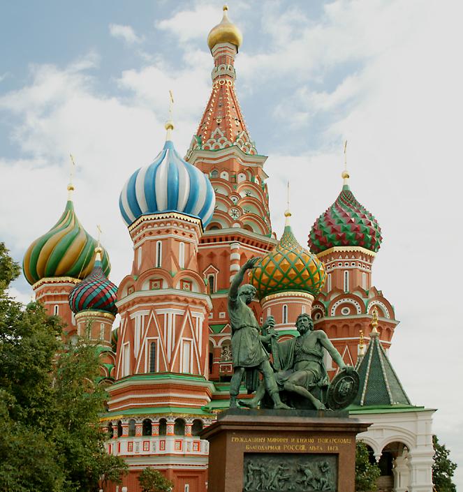
http://www.richard-seaman.com/Travel/Russia/Moscow/Highlights/StBasilsWithStatue.jpg
Russia
Text from http://en.wikipedia.org 19.02.2010
2. What caused the Dead Sea to form?
This lesson takes us back to the subject of plate tectonics. In this part of the world there is a rift forming where two crustal plates are spreading apart. The East Rift Valley runs through most of Africa, but it starts north of the Dead Sea and runs south along the eastern side of the continent. The Sea is located right along the Rift Valley where the earth's crust is being stretched thin. To get an idea of how this "crustal spreading" thing works, take a bar of taffy, or taffy-like candy and try to pull it apart. You'll see where the candy starts to come apart it gets really thin just before it breaks. That's what is happening to the earth's crust in the Rift Valley. Where the earth's crust gets thin that part of the surface sinks downward. You know what? The Dead Sea is still sinking lower, even today. Scientists figure that the Dead Sea lowers by as much as 13 inches per year. On a geologic time scale that's incredibly fast!
The dead sea resides in Israel and in Jordan.
http://www.atlastours.net/jordan/dead_sea_sunset.jpg
Text from http://www.extremescience.com/index.html 19.02.2010
3. Puncak Jaya was originally called 'Carstensz Pyramid', after Dutch explorer Jan Carstensz who first sighted the glaciers on the peak of the mountain on a rare clear day in 1623 (Carstensz was ridiculed in Europe when he said he had seen snow near the equator) This name is still used among mountaineers Although the snowfield of Puncak Jaya was reached as early as 1909 by a Dutch explorer, Hendrik A. Lorentz, the peak was not climbed until 1962, by an expedition led by the Austrian mountaineer Heinrich Harrer (of Seven Years in Tibet fame) with three friends — Temple, Kippax and Huizenga.
In the highland areas, day time temperatures should range between 75 and 45 degrees -F with most evenings about 45 degrees -F Expect warm afternoon showers, which may turn cool in encountered on a mountain pass. Closer to Carstensz, snow or inclement weather may accrue. Temperatures can range from 28 degree-F to 60 degree-F with sunshine occasionally in the mornigs, then rainfall in the afternoons and evenings. Winds are variable and can be strong.
Text from http://peakbagger.com 19.02.2010
4. The Yangtze River, or Chang Jiang (simplified Chinese: 长江; traditional Chinese: 長江; pinyin: Cháng Jiāng), Tibetan: 'Bri-chu, is the longest river in China and Asia, and the third-longest in the world, after the Nile in Africa and the Amazon.
The river is about 6300 km long (3915 mi) and flows from its source in Qinghai Province, eastwards into the East China Sea at Shanghai. It acts as a dividing line between North and South China, although geographers generally consider the Qinling-Huai River line to be the official line of geographical division. As the largest river in the region, the Yangtze is historically, culturally, and economically important to China. One of the dams on the river, the Three Gorges Dam, is the largest hydro-electric power station in the world.[2] The section of the river flowing through deep gorges in Yunnan province is part of the Three Parallel Rivers of Yunnan Protected Areas: a UNESCO World Heritage Site.
The name Yangtze River, as well as various similar names such as Yangtse River, Yangzi River, Yangtze Kiang, etc., is derived from Yangzi Jiang (simplified Chinese: 扬子江; traditional Chinese: 揚子江; pinyin: Yángzǐ Jiāng) listen (help•info), which, beginning in the Sui Dynasty, was the Chinese name for the river in its lower reaches, specifically, the stretch between Yangzhou (扬州) and Zhenjiang (镇江). The name comes from the ancient ferry crossing Yangzi Jin (扬子津, meaning "Yangzi Crossing"). From the Ming Dynasty, the name was sometimes written 洋子 (yángzĭ). Because it was the name first heard by missionaries and traders, this name was applied in English to the whole river. In Chinese, Yangzi Jiang is considered a historical or poetic name for the river. The modern Chinese name, Chang Jiang (长江/長江 Cháng Jiāng), literally means "long 'Jiang'" (Jiang is the classical Chinese of Yangtze, but now it means river) and may sometimes also be used in English. It is also known to many as the 'Main Street' of China.
http://dicksdoings.com/yahoo_site_admin/assets/images/YangtzeRiver.77115606.jpg
Text from http://www.wikipedia.org/ 19.02.2010
5. The Mariana Trench (or Marianas Trench) is the deepest known part of the world's oceans, and the lowest elevation of the surface of the Earth's crust. It is located in the western Pacific Ocean, to the east of the Mariana Islands. The trench is about 2,550 kilometres (1,580 mi) long but has a mean width of only 69 kilometres (43 mi). It reaches a maximum depth of about 11,033 metres (36,200 ft) at the Challenger Deep, a small slot-shaped valley in its floor, at its southern end.[1]
Part of the Izu-Bonin-Mariana Arc system, the trench forms the boundary between two tectonic plates, where the western edge of the Pacific Plate is subducted beneath the small Mariana Plate. Because the Pacific plate is the largest of all the tectonic plates on Earth, crustal material at its western edge has had a long time since formation (up to 170 million years) to compact and become very dense; hence its great height-difference relative to the higher-riding Mariana Plate, at the point where the Pacific Plate crust is subducted. This deep area is the Mariana trench proper. The movement of these plates is also responsible for the formation of the Mariana Islands.
At the bottom of the trench, where the plates meet, the water column above exerts a pressure of 108.6 megapascals (15,750 psi), over one thousand times the standard atmospheric pressure at sea level. If Mount Everest, the highest mountain on Earth at 8,848 metres (29,030 ft), were set in the deepest part of the Mariana Trench, there would be 2,076 metres (6,810 ft) of water left above it.[1]
Because the Earth is not a perfect sphere, the trench is not the part of the seafloor closest to the center of the Earth - parts of the Arctic Ocean seabed are at least 13,000 meters closer to the center than the Challenger deep seafloor.
Text from http://www.wikipedia.org 19.02.2010
6. Sir Walter Raleigh was an English aristocrat, writer, poet, soldier, courtier, and explorer.
In 1591 he secretly married Elizabeth Throckmorton, one of the Queen's ladies-in-waiting, without requesting the Queen's permission, for which he and his wife were sent to the Tower of London. After his release, they retired to his estate at Sherborne, Dorset.
Raleigh was born to a Protestant family in Devon, the son of Walter Raleigh and Catherine Champernowne. Little is known for certain of his early life, though he spent some time in Ireland, in Killua Castle, Clonmellon, County Westmeath, taking part in the suppression of rebellions and participating in two infamous massacres at Rathlin Island and Smerwick. Later he became a landlord of properties confiscated from the Irish. He rose rapidly in Queen Elizabeth I's favour, being knighted in 1585. He was involved in the early English colonisation of the New World in Virginia under a royal patent.
Text from http://www.elizabethan-era.org.uk/sir-walter-raleigh.htm 19.02.2010
7. The biggest body of water is the Pacific Ocean. Its name is derived from the Luso-Latin macaronic Tepre Pacificum, "peaceful sea", bestowed upon it by the Portuguese explorer Ferdinand Magellan[citation needed]. It extends from the Arctic in the north to the Southern Ocean in the south, bounded by Asia and Australia in the west, and the Americas in the east.
At 169.2 million square kilometres (65.3 million square miles) in area, this largest division of the World Ocean – and, in turn, the hydrosphere – covers about 46% of the Earth's water surface and about 30% of its total surface.The equator subdivides it into the North Pacific Ocean and South Pacific Ocean, with two exceptions: the Galápagos and Gilbert Islands, while straddling the equator, are deemed wholly within the South Pacific. The Mariana Trench in the western North Pacific is the deepest point in the Pacific and in the world, reaching a depth of 10,911 metres (35,800 ft).
Text from http://en.wikipedia.org 19.02.2010
8. The Sahara (Arabic: الصحراء الكبرى, aṣ-ṣaḥrā´ al-kubra, "The Greatest Desert") is the world's largest hot desert. At over 9,000,000 square kilometres (3,500,000 sq mi), it covers most of Northern Africa, making it almost as large as the United States or the continent of Europe. The desert stretches from the Red Sea, including parts of the Mediterranean coasts, to the outskirts of the Atlantic Ocean. To the south, it is delimited by the Sahel: a belt of semi-arid tropical savanna that comprises the northern region of central and western Sub-Saharan Africa.
The Sahara has an intermittent history that may go back as much as 3 million years.Some of the sand dunes can reach 180 metres (600 ft) in height.The name comes from the Arabic word for desert: (صَحراء), "ṣaḥrā´".
Berbers
Berbers are one of the oldest known inhabitants of the Sahara Desert.They are the people that occupied (and still occupy) more than two thirds of the Sahara's total surface.[citation needed]The Garamantes Berbers built a prosperous empire in the heart of the desert.[citation needed] The Tuareg nomads continue, to present day, to inhabit and move across wide Sahara surfaces in Algeria, Mali, Niger, Mauritania, and Libya. Some of the oldest Berber Tifinagh inscriptions are found in Southern Algeria, Northern Mali and Niger.
Egyptians
By 6000 BC predynastic Egyptians in the southwestern corner of Egypt were herding cattle and constructing large buildings. Subsistence in organized and permanent settlements in predynastic Egypt by the middle of the 6th millennium BC centered predominantly on cereal and animal agriculture: cattle, goats, pigs and sheep. Metal objects replaced prior ones of stone. Tanning of animal skins, pottery and weaving are commonplace in this era also.There are indications of seasonal or only temporary occupation of the Al Fayyum in the 6th millennium BC, with food activities centering on fishing, hunting and food-gathering. Stone arrowheads, knives and scrapers are common.Burial items include pottery, jewelry, farming and hunting equipment, and assorted foods including dried meat and fruit. Burial in desert environments appears to enhance Egyptian preservation rites, and dead are buried facing due west.By 3400 BC, the Sahara was as dry as it is today, and it became a largely impenetrable barrier to humans, with only scattered settlements around the oases, but little trade or commerce through the desert. The one major exception was the Nile Valley. The Nile, however, was impassable at several cataracts, making trade and contact by boat difficult.

http://funwebtest.epfl.ch/site2004/cecile/images/sahara.jpg
Nubians
During the Neolithic, before the onset of desertification, around 9500 BC the central Sudan had been a rich environment supporting a large population ranging across what is now barren desert, like the Wadi el-Qa'ab. By the 5th millennium BC, the peoples who inhabited what is now called Nubia, were full participants in the "agricultural revolution," living a settled lifestyle with domesticated plants and animals. Saharan rock art of cattle and herdsmen found suggests the presence of a cattle cult like those found in Sudan and other pastoral societies in Africa today.Megaliths found at Nabta Playa are overt examples of probably the world's first known Archaeoastronomy devices, predating Stonehenge by some 1000 years.This complexity, as observed at Nabta Playa, and as expressed by different levels of authority within the society there, likely formed the basis for the structure of both the Neolithic society at Nabta and the Old Kingdom of Egypt.[36]
Phoenicians
The peoples of Phoenicia, who flourished between 1200-800 BC, created a confederation of kingdoms across the entire Sahara to Egypt. They generally settled along the Mediterranean coast, as well as the Sahara, among the peoples of Ancient Libya, who were the ancestors of peoples who speak Berber languages in North Africa and the Sahara today, including the Tuareg of the central Sahara.
The Phoenician alphabet seems to have been adopted by the ancient Libyans of north Africa, and Tifinagh is still used today by Berber-speaking Tuareg camel herders of the central Sahara.
Sometime between 633 BC and 530 BC, Hanno the Navigator either established or reinforced Phoenician colonies in Western Sahara, but all ancient remains have vanished with virtually no trace.
Greeks
By 500 BC, a new influence arrived in the form of the Greeks. Greek traders spread along the eastern coast of the desert, establishing trading colonies along the Red Sea coast. The Carthaginians explored the Atlantic coast of the desert. But the turbulence of the waters and the lack of markets never led to an extensive presence further south than modern Morocco. Centralized states thus surrounded the desert on the north and east; it remained outside the control of these states. Raids from the nomadic Berber people of the desert were a constant concern of those living on the edge of the desert.

http://www.juanita.ca/Saharagallery/TheSahara.jpg
Urban civilization
An urban civilization, the Garamantes, arose around this time in the heart of the Sahara, in a valley that is now called the Wadi al-Ajal in Fazzan, Libya.The Garamantes achieved this development by digging tunnels far into the mountains flanking the valley to tap fossil water and bring it to their fields. The Garamantes grew populous and strong, conquering their neighbors and capturing many slaves (which were put to work extending the tunnels). The ancient Greeks and the Romans knew of the Garamantes and regarded them as uncivilized nomads. However, they traded with the Garamantes, and a Roman bath has been found in the Garamantes capital of Garama. Archaeologists have found eight major towns and many other important settlements in the Garamantes territory. The Garamantes civilization eventually collapsed after they had depleted available water in the aquifers, and could no longer sustain the effort to extend the tunnels still further into the mountains.
Text from http://en.wikipedia.org 19.02.2010
9. America was named after Amerigo Vespucci in 1507. A man called Regiomontanus was famous as a Medieval Scientist, Mathematician and Astronomer. His book Ephemerides was used by Christopher Columbus and Amerigo Vespucci to measure longitudes in their explorations of the New World.

http://freepages.history.rootsweb.ancestry.com/~wcarr1/Lossing1/00-11.gif
Text from http://www.elizabethan-era.org.uk/famous-explorers.htm 19.02.2010
10.Francisco Pizarro conquered the Peru in 1532. He founded the city named Lima and defeated the incas.

Text from http://www.elizabethan-era.org.uk/francisco-pizarro.htm 19.02.2010

No comments:
Post a Comment